 Lebensraumvernetzung Geodata
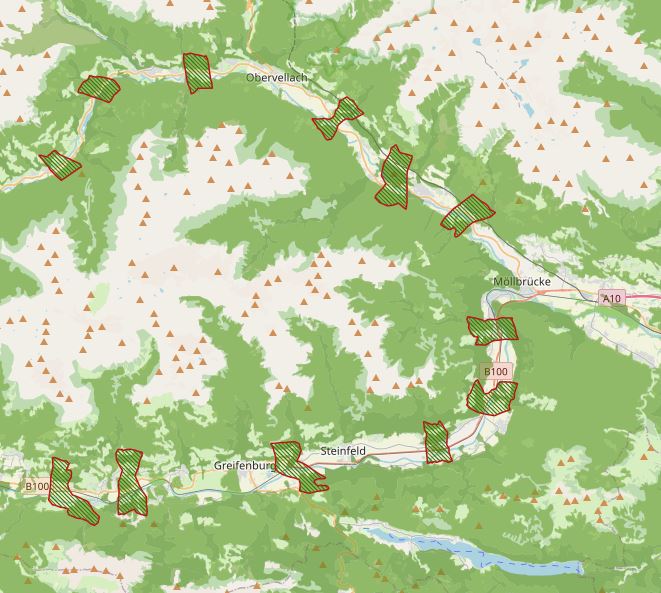
Ecological Corridors Carinthia
Note on location accuracy: Data sets do not have area-specific delineations and are not suitable to be intersected with the cadastre. Designation of habitat axes in Carinthia. GIS-based modeling with subsequent validation and final designation of migration axes by the "Büro für Wildökologie und Forstwirtschaft"
Simple
Identification info
- Date (Creation)
- 2008-06-09
- Edition
- Version 1
- Purpose
- Designation and protection of ecological corridors in carinthia
- Status
- Completed
Originator
Büro für Wildökologie und Forstwirtschaft - ()
- Spatial representation type
- Vector
Spatial resolution
Equivalent scale
- Denominator
- 10000
- Topic category
-
- Biota
Extent
N
S
E
W
))
Extent
Temporal extent
- Time period
- 2008-01-01 2008-01-01
- Maintenance and update frequency
- Irregular
- Keywords (Theme)
-
- carithia
Resource constraints
- Access constraints
- Copyright
- Use constraints
- Copyright
- Other constraints
- When using the data in the copyright notice "© - Kärntner Landesjägerschaft" indicate
- Language
- English
- Character encoding
- UTF8
Distribution Information
- OnLine resource
-
Wildlife Corridors and Open Space Cores Carinthia (ESRI Shapefile)Wildtierkorridore und Freiraumkerne Kärnten (ESRI-Shapefile)
Computer-based modeling of the connectivity potential in Carinthia with subsequent validation and final designation by the office "Bürö für Wildtieökologie und Fortswirtschaft".)
Resource lineage
- Statement
- Computer-based modeling of connectivity potential in Carinthia with subsequent validation une final designation dürch the office "Bürö für Wildtieökologie und Fortswirtschaft).
- Hierarchy level
- Dataset
Reference System Information
- Reference system identifier
- 31258
Metadata
- Metadata identifier
- urn:uuid/1ff7b48b-7151-42cf-b20f-cafc20b2f2df
- Language
- English
- Character encoding
- UTF8
- Language
- Français
- Language
- Deutsch
- Language
- Chineseutres
- Language
- Spanish; Castilian
- Language
- Arabic
- Language
- Russian
Point of contact
- Metadata linkage
- https://geonetwork.lebensraumvernetzung.at/geonetwork/srv/api/records/1ff7b48b-7151-42cf-b20f-cafc20b2f2df
- Date info (Revision)
- 2022-08-23T08:49:02
- Date info (Creation)
- 2022-08-02T14:46:24
Metadata standard
- Title
- ISO 19115-3
Overviews
kaernten1.JPG
Spatial extent
N
S
E
W
Provided by

Associated resources
Not available