 Lebensraumvernetzung Geodata
ConNat . Connecting Nature
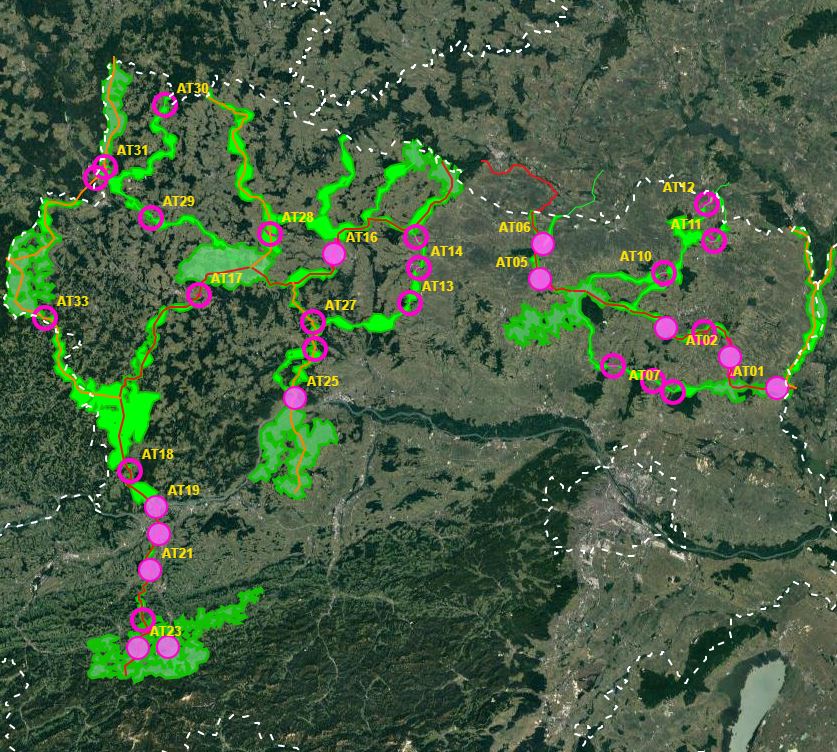
First of all, a GIS model was created, which aims to use a least-cost path algorithm to determine the general course of the corridors as precisely and in as much detail as possible. This is particularly necessary because the area under investigation, at more than 30,000km², covers more than a third of the total size of Austria - and thus could not be processed in a justifiable time frame on an expert basis alone.
In a next step, the results of the GIS model will be used as a basis for further expert work. This offers the possibility to additionally take into account local particularities as well as findings from workshops, etc. This way, a result can be elaborated that can be used as a basis for the development of the GIS model.
In this way, a result can be developed that is spatially accurate even at a scale of 1 : 10,000 - and not only in the bottlenecks.
- ConNat-AT as Shapefile:ConNat-AT-KorrEngstKern-UTM-N33.zip
Zip -File: complete dataset of all narrows, corridors and core areas in Austria (Esri Shapefile, EPSG 25833 (UTM N33, ETRS 1989)). Attributes: Name (designation), Cat (category: 1 core area, 2 corridor, 3 narrows), Info (link to further information), ESPrior (narrows priority: 0 no narrows, 1 primary narrows, 2 secondary narrows), Area (in ha).
- ConNat-AT and Lower Austrian axes as shapefile:NOeWildKorrMittellinieEPSG25833.zip
Zip file: Corridor axes in Lower Austria: ConNat and already existing axes from Lower Austria Atlas (Esri Shapefile, EPSG 25833 (UTM N33, ETRS 1989)). Attributes: Name (designation), SymbolID (0 international corridor, 1 supraregional corridor, 2 regional corridor), Buffer (radius in metres), LASTUPDATE (last change).
Simple
Identification info
- Date (Creation)
- 2021-08-24
- Purpose
- Safeguarding habitat corridors in Lower Austria
- Status
Originator
- Spatial representation type
- Vector
Spatial resolution
Equivalent scale
- Denominator
- 10000
- Topic category
-
- Biota
Extent
))
Extent
Temporal extent
- Time period
- 2021-01-24
- Maintenance and update frequency
- As needed
- Keywords (Theme)
-
- ConNat
- Keywords (Place)
-
- World
Resource constraints
- Access constraints
- Copyright
- Use constraints
- Copyright
- Other constraints
- not defined
- Language
- English
- Character encoding
- UTF8
Distribution Information
- OnLine resource
-
ConNat-AT-KorrEngstKern-UTM-N33.zip
-Zip -File: complete dataset of all narrows, corridors and core areas in Austria (Esri Shapefile, EPSG 25833 (UTM N33, ETRS 1989)). Attributes: Name (designation), Cat (category: 1 core area, 2 corridor, 3 narrows), Info (link to further information), ESPrior (narrows priority: 0 no narrows, 1 primary narrows, 2 secondary narrows), Area (in ha).
- OnLine resource
-
NOeWildKorrMittellinieEPSG25833.zip (ESRI Shapefile)
Zip -File: Corridor axes in Lower Austria: ConNat and already existing axes from NÖ Atlas (Esri Shapefile, EPSG 25833 (UTM N33, ETRS 1989)). Attributes: Name (designation), SymbolID (0 international corridor, 1 supraregional corridor, 2 regional corridor), Buffer (radius in metres), LASTUPDATE (last change).
- OnLine resource
-
Action Plan
PDF-Document Action Plan
- OnLine resource
-
PDF-Map
PDF-Map of corrdiors in Lower Austria
Resource lineage
- Statement
- See Abstract.: Further detailed information: https://boku.ac.at/rali/geomatics/themenfelder/fernerkundung-und-gis/connat-1
- Hierarchy level
- Dataset
Reference System Information
- Reference system identifier
- EPSG 25833
Metadata
- Metadata identifier
- urn:uuid/041d6433-072a-40f0-8087-31e728ba8340
- Language
- English
- Character encoding
- UTF8
- Language
- Français
- Language
- Deutsch
- Language
- Chineseutres
- Language
- Spanish; Castilian
- Language
- Arabic
- Language
- Russian
Point of contact
- Metadata linkage
- https://geonetwork.lebensraumvernetzung.at/geonetwork/srv/api/records/041d6433-072a-40f0-8087-31e728ba8340
- Date info (Creation)
- 2022-08-24T11:34:30
- Date info (Revision)
- 2026-01-27T08:44:08
Metadata standard
- Title
- ISO 19115-3
Overviews
Spatial extent
Provided by
