 Lebensraumvernetzung Geodata
Wildcat Corridors Lower Austria
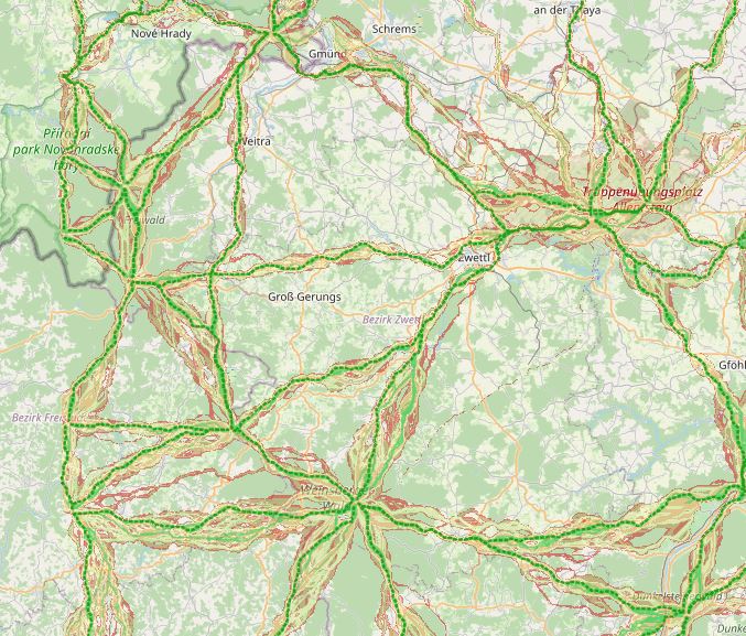
In spring 2019, the NP Thayatal GmbH commissioned the Büro für Wildökologie und Forstwirtschaft e.U. (Office for Wildlife Ecology and Forestry) to prepare a wildcat corridor plan in the Wald- & Weinviertel in Austria and the districts of South Bohemia and South Moravia in the Czech Republic as part of the Interreg project MaGICLandscapes.
For the study area in Austria and the Czech Republic, the habitat potential of the European wildcat is to be estimated in the form of a habitat model. Based on the habitat model, a corridor analysis will show the possible distribution routes of the cat.
As a further step, a strategy and action plan will be developed to provide a basis for improving and expanding migration corridors and thus dispersal opportunities for the wildcat along the green infrastructure. Within the framework of the MaGICLandscapes project, the research results serve as a basis for the planning, construction and management of green infrastructure. For the National Park Thayatal, they serve as input for the further procedure in wildcat management and are taken into account in the wildcat population support concept.
See further information: https://lebensraumvernetzung.at/publikationen/Leitner-2020-Wildkatzenkorridorplan-Endbericht-2021-04-19-web.pdf
Simple
Information de l'identification
- Date (Création)
- 2020-01-01
- Edition
- Version 1
- But
- Securing corridors for the wildcat in Lower Austria
- Etat
- Accepté
A l’origine de
- Type de représentation spatiale
- Vecteur
Résolution spatiale
Echelle comparative
- Dénominateur
- 10000
- Catégorie ISO
-
- Biologie, faune et flore
Etendue
))
Etendue
Etendue temporelle
- Période
- 2020-01-01
- Fréquence de mise à jour
- Non planifiée
- Mots clés (Thème)
-
- Wildcat
- Mots clés (Localisation)
-
- World
Contraintes sur la ressource
- Contraintes d'accès
- Droit d’auteur / Droit moral (copyright)
- Contraintes d'utilisation
- Droit d’auteur / Droit moral (copyright)
- Autres contraintes
- Released for use. No parcel delineation
- Langue
- English
- Encodage de caractères
- Utf8
- Informations supplémentaires
- No parcel sharp delineation. Not suitable for intersection analyses with the cadastre
Informations sur la distribution
- Ressource en ligne
-
WIldkatzendorridore (inklusive QGIS-Projekt)
Alle Daten zu den Wildtierkorridoren in NÖ. Mittellinie der Korridore & flächige Darstellung der Korridore (GeoTiff-Format)
Généalogie des ressources
- Généralités sur la provenance
- GIS-based designation of corridors for the wildcat in Lower Austria.
- Niveau
- Jeu de données
Information sur le système de référence
- Nom du système de référence
- EPSG:25833
Métadonnées
- Identifiant de la fiche
- urn:uuid/f1cfe817-925f-4592-938c-f1b54c5abdd1
- Langue
- English
- Encodage de caractères
- Utf8
- Langue
- Français
- Langue
- Deutsch
- Langue
- Chineseutres
- Langue
- Spanish; Castilian
- Langue
- Arabic
- Langue
- Russian
Point de contact
- Lien vers la métadonnée
- https://geonetwork.lebensraumvernetzung.at/geonetwork/srv/api/records/f1cfe817-925f-4592-938c-f1b54c5abdd1
- Informations de date (Création)
- 2022-08-23T19:49:07
- Informations de date (Révision)
- 2026-01-27T09:00:20
Norme des métadonnées
- Titre
- ISO 19115-3
Étendue spatiale
