 Lebensraumvernetzung Geodata
Aktuelle Version Lebensraumkorridore Österreich (Version 2025-09-15)
Aktuelle Version Lebensraumkorridore Österreich (Version 2025-09-15)
LRVA-2025: Current version of the integral dataset on habitat connectivity in Austria. This dataset takes into account all datasets and designations of habitat corridors from scientific projects and public sector projects (federal provinces). The dataset has been evaluated by the experts of the Cooridnation Platform "Habitat Connectivity Austria" and is updated as soon as new information and designations from projects are available. Further details are available in the endreport: https://docs.umweltbundesamt.at/s/AzZrHid6q9wkDDM
As part of the update, the underlying data model was adapted. It is now possible to track all changes made during the update. All updated and valid habitat corridors can be obtained by selecting all edges that have the value “true” in the “valid” data set property. All edges with the value “false” are no longer valid. The reasons for the changes are noted in the ‘comment’ data record property. Most of the changes are so-called “technical changes.” As part of these changes, corridors have been adapted accordingly due to errors in the spatial location of existing crossing structures. The reclassification of corridors is due to new planned or adapted locations of wildlife crossing aids along the existing route.
Description of the feature properties see feature catalog:
Data set download at: https://docs.umweltbundesamt.at/s/ep9JF44TjYxDY54,
also includes QGIS project for direct use of the GPKG file. Two visualizations available.
- Corridors classified by corridor category (supra-regional | regional | local) (see Quicklook)
- Change layer: Current corridors and all outdated/revised corridor sections
LRVA-2025: Aktuelle Version des integralen Datensatzes zur Lebensraumvernetzung in Österreich. Dieser Datensatz berücksichtigt alle Datensätze und Ausweisungen von Lebensraumkorridoren aus wissenschaftlichen Projekten und Projekten der öffentlichen Hand (Bundesländer). Der Datensatz wurde von den Experten der Koordinationsplattform "Lebensraumvernetzung Österreich" evaluiert und sobald neue Erkenntnisse und Ausweisungen aus Projekten vorliegen aktualisiert. Weitere Informationen siehe Endbericht: https://docs.umweltbundesamt.at/s/AzZrHid6q9wkDDM
Im Rahmen der Aktualisierung wurde das zugrundliegende Datenmodell adaptiert. In diesem ist es jetzt möglich alle bei der Aktualisierung vorgenommen Änderungen nachzuvollziehen. Alle aktualisierten und gültigen Lebensraumkorridore erhält man durch das selektieren aller Kanten welche in der Datensatzeigenschaft "valide" den Wert "true" aufweisen. Alle Kanten welche den Wert "false" aufweisen sind nicht mehr gültig. Der Grund für die Änderungen sind in der Datensatzeigenschaft "anmerkung" vermerkt. Bei den meisten Änderungen handelt es sich um sogenannte "technische Änderungen". Im Rahmen dieser wurden Korridore aufgrund Fehler in der Lange von existierenden Querungsbauwerken entsprechend adaptiert. Die Neuausweisungen von Korridore sind auf neue geplante bzw. die Adaptierung von Standorten von Wildtierquerungshilfen über die existierende Bestandesstrecke zurück zu führen.
Beschreibung der Attribute des Datensatzes im Feature Catalogue:
Datensatz-Download unter: https://docs.umweltbundesamt.at/s/ep9JF44TjYxDY54,
beinhaltet auch QGIS-Projekt für die direkte Nutzung des GPKG-Files.
Zwei Visualisierungen vorhanden.
- Korridore klassifiziert nach Korridorkategorie (Überregional | Regional | Lokal) (siehe Quicklook)
- Veränderungslayer: Aktuelle Korridore und alle veralteten/revidierten Korridorabschnitte
Simple
Information de l'identification
Identification info
Identification info
Identification info
Identification info
Identification info
Identification info
-
Date (Dernière mise à jour)Date (Last Update)Date (Last Update)Date (Last Update)Date (Last Update)Date (Last Update)Date (Last Update)
- 2025-09-15
-
EditionEditionEditionEditionEditionEditionEdition
- Version 2025-09-15
-
ButPurposePurposePurposePurposePurposePurpose
-
Basis for protecting ecological corridors in spatial planning and by nature conservation. Basis for the consideration of ecological corridors in nature conservation planning.Grundlage für die Absicherung Lebensraumkorridore in der Raumplanung und durch den Naturschutz. Grundlage für die Berücksichtigung der Lebensraumkorridore in naturschutzfachlichen Planungen
-
EtatStatusStatusStatusStatusStatusStatus
-
ValideValidValidValidValidValidValid
Point de contact
Point of contact
Point of contact
Point of contact
Point of contact
Point of contact
Point of contact
-
Type de représentation spatialeSpatial representation typeSpatial representation typeSpatial representation typeSpatial representation typeSpatial representation typeSpatial representation type
-
VecteurVectorVectorVectorVectorVectorVector
Résolution spatiale
Spatial resolution
Spatial resolution
Spatial resolution
Spatial resolution
Spatial resolution
Spatial resolution
Echelle comparative
Equivalent scale
Equivalent scale
Equivalent scale
Equivalent scale
Equivalent scale
Equivalent scale
-
DénominateurDenominatorDenominatorDenominatorDenominatorDenominatorDenominator
- 25000
-
Catégorie ISOTopic categoryTopic categoryTopic categoryTopic categoryTopic categoryTopic category
-
-
EnvironnementEnvironmentEnvironmentEnvironmentEnvironmentEnvironmentEnvironment
-
Etendue
Extent
Extent
Extent
Extent
Extent
Extent
))
Etendue
Extent
Extent
Extent
Extent
Extent
Extent
Etendue temporelle
Temporal extent
Temporal extent
Temporal extent
Temporal extent
Temporal extent
Temporal extent
-
PériodeTime periodTime periodTime periodTime periodTime periodTime period
- 2022-07-01
-
Fréquence de mise à jourMaintenance and update frequencyMaintenance and update frequencyMaintenance and update frequencyMaintenance and update frequencyMaintenance and update frequencyMaintenance and update frequency
-
ContinueContinualContinualContinualContinualContinualContinual
- Keywords
-
-
Austria2025Österreich2025
-
LRVA-2025LRVA-2025
-
- Keywords
-
-
AustriaÖsterreich
-
Contraintes sur la ressource
Resource constraints
Resource constraints
Resource constraints
Resource constraints
Resource constraints
Resource constraints
-
Contraintes d'accèsAccess constraintsAccess constraintsAccess constraintsAccess constraintsAccess constraintsAccess constraints
-
Autres restrictionsOther restrictionsOther restrictionsOther restrictionsOther restrictionsOther restrictionsOther restrictions
-
Contraintes d'utilisationUse constraintsUse constraintsUse constraintsUse constraintsUse constraintsUse constraints
-
Autres restrictionsOther restrictionsOther restrictionsOther restrictionsOther restrictionsOther restrictionsOther restrictions
-
Autres contraintesOther constraintsOther constraintsOther constraintsOther constraintsOther constraintsOther constraints
-
Creative Commons Lizenz CC-BY-AT 4.0
-
LangueLanguageLanguageLanguageLanguageLanguageLanguage
- Deutsch
-
Encodage de caractèresCharacter encodingCharacter encodingCharacter encodingCharacter encodingCharacter encodingCharacter encoding
-
Utf8UTF8UTF8UTF8UTF8UTF8UTF8
-
Informations supplémentairesSupplemental InformationSupplemental InformationSupplemental InformationSupplemental InformationSupplemental InformationSupplemental Information
-
See Report: https://geonode.lebensraumvernetzung.at/documents/107/downloadSiehe Endbericht: https://geonode.lebensraumvernetzung.at/documents/107/download
Information sur le contenu
Content Information
Content Information
Content Information
Content Information
Content Information
Content Information
-
Référence du catalogue d'objetFeature catalogue citationFeature catalogue citationFeature catalogue citationFeature catalogue citationFeature catalogue citationFeature catalogue citation
Informations sur la distribution
Distribution Information
Distribution Information
Distribution Information
Distribution Information
Distribution Information
Distribution Information
-
Ressource en ligneOnLine resourceOnLine resourceOnLine resourceOnLine resourceOnLine resourceOnLine resource
-
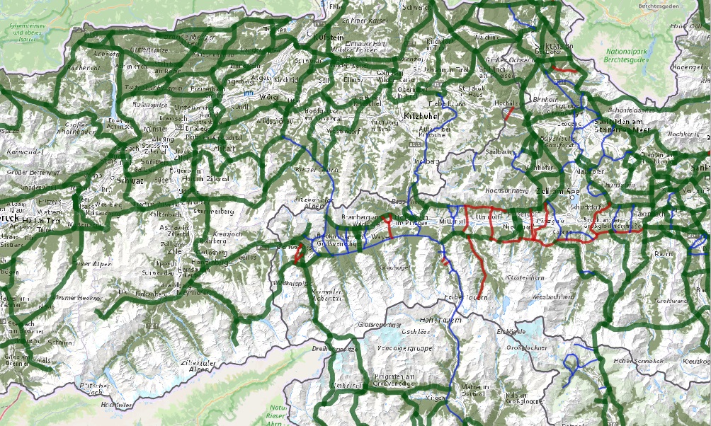
Map of the resourceMap of the resourceInteraktive KarteMap of the resourceMap of the resourceMap of the resourceMap of the resource
Map ecological corridors AustriaKarte zur Lebensraumvernetzung in Österreich
-
Ressource en ligneOnLine resourceOnLine resourceOnLine resourceOnLine resourceOnLine resourceOnLine resource
-
Download dataset (Geopackage-format - 50 MB)Download a copyDownload Datensatz (Geopackage-Format - 50 MB)Download a copyDownload a copyDownload a copyDownload a copy
Includes QGIS project for direct use of the GPKG file. Two visualizations available. - Corridors classified by corridor category (supra-regionalAktueller Kantengraph zu den Lebensraumachsen in Österreich. QGIS-Projektfile wird ebenfalls zur Verfügung gestellt. Zwei Visualisierungen vorhanden. - Korridore klassifiziert nach Korridorkategorie (Überregional
-
Ressource en ligneOnLine resourceOnLine resourceOnLine resourceOnLine resourceOnLine resourceOnLine resource
-
lrv:Lebensraumkorridore_Version_2025
Lebensraumkorridore Version 2025
-
Ressource en ligneOnLine resourceOnLine resourceOnLine resourceOnLine resourceOnLine resourceOnLine resource
-
lrv:Lebensraumkorridore_Version_2025
Lebensraumkorridore Version 2025
Généalogie des ressources
Resource lineage
Resource lineage
Resource lineage
Resource lineage
Resource lineage
Resource lineage
-
Généralités sur la provenanceStatementStatementStatementStatementStatementStatement
-
Data set takes into account all existing data sets from scientific projects and projects of the public sector (federal states). All datasets considered are referenced in the linked resources and are also available in this portal.Der Datensatz berücksichtigt alle vorhandenen Datensätze aus wissenschaftlichen Projekten und Projekten der öffentlichen Hand (Bundesländer). Alle berücksichtigten Datensätze werden in den verlinkten Ressourcen referenziert und sind auch in diesem Portal verfügbar.
-
NiveauHierarchy levelHierarchy levelHierarchy levelHierarchy levelHierarchy levelHierarchy level
-
Jeu de donnéesDatasetDatasetDatasetDatasetDatasetDataset
-
SourceSourceSourceSourceSourceSourceSource
-
- Alpine Carpathian Corridor (ACC Corridor)
- Ecological Corridors Salzburg
- Ecological Corridors Stryria
- Ecological Corridors Upper Austria
- Deprecated: Austrian Ecological Corridors - Version 2018
- ConNat . Connecting Nature
- Wildcat Corridors Lower Austria
- Deprecated: LRVA-2022: Lebensraumkorridore Österreich (Version 2022-10-16)
Information sur le système de référence
Reference System Information
Reference System Information
Reference System Information
Reference System Information
Reference System Information
Reference System Information
-
Nom du système de référenceReference system identifierReference system identifierReference system identifierReference system identifierReference system identifierReference system identifier
- EPSG: 31287
Metadata
-
Identifiant de la ficheMetadata identifierMetadata identifierMetadata identifierMetadata identifierMetadata identifierMetadata identifier
- urn:uuid/90e852dc-8cb5-4f8d-a571-daa333d3ef64
-
LangueLanguageLanguageLanguageLanguageLanguageLanguage
- English
-
Encodage de caractèresCharacter encodingCharacter encodingCharacter encodingCharacter encodingCharacter encodingCharacter encoding
-
Utf8UTF8UTF8UTF8UTF8UTF8UTF8
-
LangueLanguageLanguageLanguageLanguageLanguageLanguage
- Français
-
LangueLanguageLanguageLanguageLanguageLanguageLanguage
- Deutsch
-
LangueLanguageLanguageLanguageLanguageLanguageLanguage
- Chineseutres
-
LangueLanguageLanguageLanguageLanguageLanguageLanguage
- Spanish; Castilian
-
LangueLanguageLanguageLanguageLanguageLanguageLanguage
- Arabic
-
LangueLanguageLanguageLanguageLanguageLanguageLanguage
- Russian
Point de contact
Point of contact
Point of contact
Point of contact
Point of contact
Point of contact
Point of contact
-
Lien vers la métadonnéeMetadata linkageMetadata linkageMetadata linkageMetadata linkageMetadata linkageMetadata linkage
- https://geonetwork.lebensraumvernetzung.at/geonetwork/srv/api/records/90e852dc-8cb5-4f8d-a571-daa333d3ef64
-
Informations de date (Révision)Date info (Revision)Date info (Revision)Date info (Revision)Date info (Revision)Date info (Revision)Date info (Revision)
- 2025-10-23T11:15:19
-
Informations de date (Création)Date info (Creation)Date info (Creation)Date info (Creation)Date info (Creation)Date info (Creation)Date info (Creation)
- 2022-07-01T14:46:24
Norme des métadonnées
Metadata standard
Metadata standard
Metadata standard
Metadata standard
Metadata standard
Metadata standard
-
TitreTitleTitleTitleTitleTitleTitle
-
ISO 19115-3ISO 19115-3
Overviews
Spatial extent
Provided by
