 Lebensraumvernetzung Geodata
Deprecated: LRVA-2022: Lebensraumkorridore Österreich (Version 2022-10-16)
Deprecated: LRVA-2022: Lebensraumkorridore Österreich (Version 2022-10-16)
LRVA-2022: Current version of the integral dataset on habitat connectivity in Austria. This dataset takes into account all datasets and designations of habitat corridors from scientific projects and public sector projects (federal provinces). The dataset has been evaluated by the experts of the Cooridnation Platform "Habitat Connectivity Austria" and is updated as soon as new information and designations from projects are available. Further details are available in the endreport: https://docs.umweltbundesamt.at/s/AzZrHid6q9wkDDM
LRVA-2022: Aktuelle Version des integralen Datensatzes zur Lebensraumvernetzung in Österreich. Dieser Datensatz berücksichtigt alle Datensätze und Ausweisungen von Lebensraumkorridoren aus wissenschaftlichen Projekten und Projekten der öffentlichen Hand (Bundesländer). Der Datensatz wurde von den Experten der Koordinationsplattform "Lebensraumvernetzung Österreich" evaluiert und sobald neue Erkenntnisse und Ausweisungen aus Projekten vorliegen aktualisiert. Weitere Informationen siehe Endbericht: https://docs.umweltbundesamt.at/s/AzZrHid6q9wkDDM
Simple
Information de l'identification
Identification info
Identification info
Identification info
Identification info
Identification info
Identification info
-
Date (Dernière mise à jour)Date (Last Update)Date (Last Update)Date (Last Update)Date (Last Update)Date (Last Update)Date (Last Update)
- 2022-07-01
-
EditionEditionEditionEditionEditionEditionEdition
- Version 2022-10-16
-
ButPurposePurposePurposePurposePurposePurpose
-
Basis for protecting ecological corridors in spatial planning and by nature conservation. Basis for the consideration of ecological corridors in nature conservation planning.Grundlage für die Absicherung Lebensraumkorridore in der Raumplanung und durch den Naturschutz. Grundlage für die Berücksichtigung der Lebensraumkorridore in naturschutzfachlichen Planungen
-
EtatStatusStatusStatusStatusStatusStatus
-
DépreciéDeprecatedDeprecatedDeprecatedDeprecatedDeprecatedDeprecated
Point de contact
Point of contact
Point of contact
Point of contact
Point of contact
Point of contact
Point of contact
-
Type de représentation spatialeSpatial representation typeSpatial representation typeSpatial representation typeSpatial representation typeSpatial representation typeSpatial representation type
-
VecteurVectorVectorVectorVectorVectorVector
Résolution spatiale
Spatial resolution
Spatial resolution
Spatial resolution
Spatial resolution
Spatial resolution
Spatial resolution
Echelle comparative
Equivalent scale
Equivalent scale
Equivalent scale
Equivalent scale
Equivalent scale
Equivalent scale
-
DénominateurDenominatorDenominatorDenominatorDenominatorDenominatorDenominator
- 25000
-
Catégorie ISOTopic categoryTopic categoryTopic categoryTopic categoryTopic categoryTopic category
-
-
EnvironnementEnvironmentEnvironmentEnvironmentEnvironmentEnvironmentEnvironment
-
Etendue
Extent
Extent
Extent
Extent
Extent
Extent
))
Etendue
Extent
Extent
Extent
Extent
Extent
Extent
Etendue temporelle
Temporal extent
Temporal extent
Temporal extent
Temporal extent
Temporal extent
Temporal extent
-
PériodeTime periodTime periodTime periodTime periodTime periodTime period
- 2022-07-01
-
Fréquence de mise à jourMaintenance and update frequencyMaintenance and update frequencyMaintenance and update frequencyMaintenance and update frequencyMaintenance and update frequencyMaintenance and update frequency
-
ContinueContinualContinualContinualContinualContinualContinual
- Keywords (LocalisationPlacePlacePlacePlacePlacePlace)
-
-
Austria2022Österreich2022
-
LRVA-2022LRVA-2022
-
- Keywords
-
-
AustriaÖsterreich
-
Contraintes sur la ressource
Resource constraints
Resource constraints
Resource constraints
Resource constraints
Resource constraints
Resource constraints
-
Contraintes d'accèsAccess constraintsAccess constraintsAccess constraintsAccess constraintsAccess constraintsAccess constraints
-
Autres restrictionsOther restrictionsOther restrictionsOther restrictionsOther restrictionsOther restrictionsOther restrictions
-
Contraintes d'utilisationUse constraintsUse constraintsUse constraintsUse constraintsUse constraintsUse constraints
-
Autres restrictionsOther restrictionsOther restrictionsOther restrictionsOther restrictionsOther restrictionsOther restrictions
-
Autres contraintesOther constraintsOther constraintsOther constraintsOther constraintsOther constraintsOther constraints
-
Creative Commons Lizenz CC-BY-AT 4.0
-
LangueLanguageLanguageLanguageLanguageLanguageLanguage
- Deutsch
-
Encodage de caractèresCharacter encodingCharacter encodingCharacter encodingCharacter encodingCharacter encodingCharacter encoding
-
Utf8UTF8UTF8UTF8UTF8UTF8UTF8
-
Informations supplémentairesSupplemental InformationSupplemental InformationSupplemental InformationSupplemental InformationSupplemental InformationSupplemental Information
-
See Report: https://geonode.lebensraumvernetzung.at/documents/107/downloadSiehe Endbericht: https://geonode.lebensraumvernetzung.at/documents/107/download
Informations sur la distribution
Distribution Information
Distribution Information
Distribution Information
Distribution Information
Distribution Information
Distribution Information
-
Ressource en ligneOnLine resourceOnLine resourceOnLine resourceOnLine resourceOnLine resourceOnLine resource
-
Map of the resourceMap of the resourceInteraktive KarteMap of the resourceMap of the resourceMap of the resourceMap of the resource
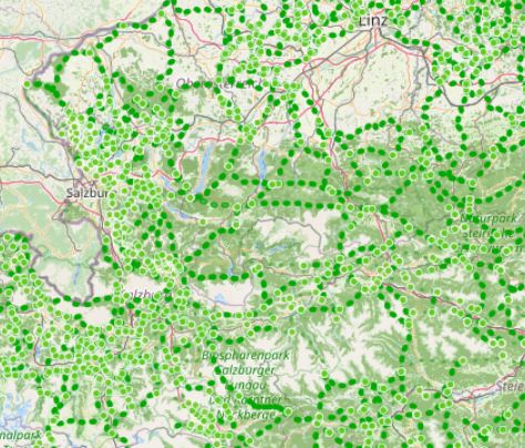
Map ecological corridors AustriaKarte zur Lebensraumvernetzung in Österreich
-
Ressource en ligneOnLine resourceOnLine resourceOnLine resourceOnLine resourceOnLine resourceOnLine resource
-
Download dataset (Geopackage-format)Download a copyDownload Datensatz (Geopackage-Format)Download a copyDownload a copyDownload a copyDownload a copy
Includes all layer files (nodes, edges, ninimum areas) of the ecological network Austria. A QGIS-project file is also provides. Styles for the layers are directly stored in the geopackageBeinhaltet alle Layer (Kanten/Knoten und Mindesflächen) der Lebensraumkorridore. QGIS-Projektfile wird ebenfalls zur Verfügung gestellt. Die Styles der einzelnen Layer sind direkt im Geopackage gespeichert.
-
Ressource en ligneOnLine resourceOnLine resourceOnLine resourceOnLine resourceOnLine resourceOnLine resource
-
geonode:LRVA_Linestring_Version_2022_10_16
LRVA_Linestring_Version_2022_10_16
-
Ressource en ligneOnLine resourceOnLine resourceOnLine resourceOnLine resourceOnLine resourceOnLine resource
-
geonode:LRVA_Nodes_Version_2022_10_16geonode:LRVA_Nodes_Version_2022_10_16
Download WFS: Nodes of the ecological network graphLade WFS-Dienst herunterDownload WFS: Knoten des LebensraumvernetzungsgraphenLade WFS-Dienst herunterLade WFS-Dienst herunterLade WFS-Dienst herunterLade WFS-Dienst herunter
-
Ressource en ligneOnLine resourceOnLine resourceOnLine resourceOnLine resourceOnLine resourceOnLine resource
-
geonode:LRVA_Polygon_Version_2022_10_16
LRVA_Polygon_Version_2022_10_16
-
Ressource en ligneOnLine resourceOnLine resourceOnLine resourceOnLine resourceOnLine resourceOnLine resource
-
geonode:LRVA_Linestring_Version_2022_10_16geonode:LRVA_Linestring_Version_2022_10_16
WMS: Egdes of ecological network graphWMS: Kanten des Lebensraumvernetzungsgraphen
-
Ressource en ligneOnLine resourceOnLine resourceOnLine resourceOnLine resourceOnLine resourceOnLine resource
-
geonode:LRVA_Nodes_Version_2022_10_16
LRVA_Nodes_Version_2022_10_16
-
Ressource en ligneOnLine resourceOnLine resourceOnLine resourceOnLine resourceOnLine resourceOnLine resource
-
geonode:LRVA_Polygon_Version_2022_10_16geonode:LRVA_Polygon_Version_2022_10_16
WMS: Minimum area of ecological corridorsDarstellungsdienst WMSWMS: Mindestfläche der LebensraumkorridoreDarstellungsdienst WMSDarstellungsdienst WMSDarstellungsdienst WMSDarstellungsdienst WMS
Généalogie des ressources
Resource lineage
Resource lineage
Resource lineage
Resource lineage
Resource lineage
Resource lineage
-
Généralités sur la provenanceStatementStatementStatementStatementStatementStatement
-
Data set takes into account all existing data sets from scientific projects and projects of the public sector (federal states). All datasets considered are referenced in the linked resources and are also available in this portal.Der Datensatz berücksichtigt alle vorhandenen Datensätze aus wissenschaftlichen Projekten und Projekten der öffentlichen Hand (Bundesländer). Alle berücksichtigten Datensätze werden in den verlinkten Ressourcen referenziert und sind auch in diesem Portal verfügbar.
-
NiveauHierarchy levelHierarchy levelHierarchy levelHierarchy levelHierarchy levelHierarchy level
-
Jeu de donnéesDatasetDatasetDatasetDatasetDatasetDataset
-
SourceSourceSourceSourceSourceSourceSource
Information sur le système de référence
Reference System Information
Reference System Information
Reference System Information
Reference System Information
Reference System Information
Reference System Information
-
Nom du système de référenceReference system identifierReference system identifierReference system identifierReference system identifierReference system identifierReference system identifier
- EPSG: 31287
Metadata
-
Identifiant de la ficheMetadata identifierMetadata identifierMetadata identifierMetadata identifierMetadata identifierMetadata identifier
- urn:uuid/a3a34de2-7431-4344-ad0a-b38b8b0bc663
-
LangueLanguageLanguageLanguageLanguageLanguageLanguage
- English
-
Encodage de caractèresCharacter encodingCharacter encodingCharacter encodingCharacter encodingCharacter encodingCharacter encoding
-
Utf8UTF8UTF8UTF8UTF8UTF8UTF8
-
LangueLanguageLanguageLanguageLanguageLanguageLanguage
- Français
-
LangueLanguageLanguageLanguageLanguageLanguageLanguage
- Deutsch
-
LangueLanguageLanguageLanguageLanguageLanguageLanguage
- Chineseutres
-
LangueLanguageLanguageLanguageLanguageLanguageLanguage
- Spanish; Castilian
-
LangueLanguageLanguageLanguageLanguageLanguageLanguage
- Arabic
-
LangueLanguageLanguageLanguageLanguageLanguageLanguage
- Russian
Point de contact
Point of contact
Point of contact
Point of contact
Point of contact
Point of contact
Point of contact
-
Lien vers la métadonnéeMetadata linkageMetadata linkageMetadata linkageMetadata linkageMetadata linkageMetadata linkage
- https://geonetwork.lebensraumvernetzung.at/geonetwork/srv/api/records/a3a34de2-7431-4344-ad0a-b38b8b0bc663
-
Informations de date (Révision)Date info (Revision)Date info (Revision)Date info (Revision)Date info (Revision)Date info (Revision)Date info (Revision)
- 2025-10-23T11:15:56
-
Informations de date (Création)Date info (Creation)Date info (Creation)Date info (Creation)Date info (Creation)Date info (Creation)Date info (Creation)
- 2022-07-01T14:46:24
Norme des métadonnées
Metadata standard
Metadata standard
Metadata standard
Metadata standard
Metadata standard
Metadata standard
-
TitreTitleTitleTitleTitleTitleTitle
-
ISO 19115-3ISO 19115-3
Overviews
Spatial extent
Provided by
