 Lebensraumvernetzung Geodata
Contact for the resource
DI Florian Danzinger
Type of resources
Topics
Keywords
Contact for the resource
Provided by
Representation types
Update frequencies
status
Scale
From
1
-
2
/
2
-
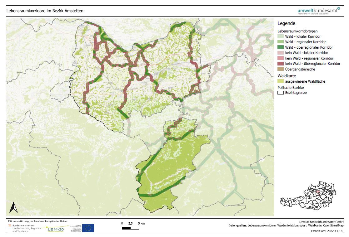
LRVA-2022: Generated standard map representation of the special topic maps for ecological corridors in Austria for the forest development plan. The maps are automatically updated as soon as the data basis (=modification of ecological corridors or modification forest mask from the Federal Forest Research Centre /BFW) changes. Details see also end report available: https://docs.umweltbundesamt.at/s/AzZrHid6q9wkDDM. QGIS-Modell for the maps generation available here: https://docs.umweltbundesamt.at/s/CjTNNLzPEKbNWyX
-
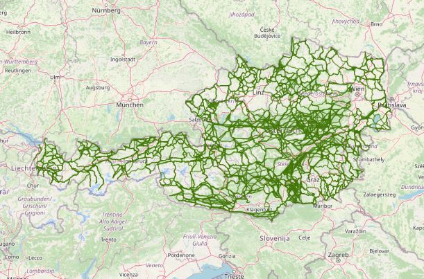
Austrian Ecological Corridors - final version. Valued by the experts of the federal provinces. Prepared in the framework of the LE project "Habitat connectivity to safeguard biodiversity in Austria".