 Lebensraumvernetzung Geodata
25000
Type of resources
Available actions
Topics
Keywords
Contact for the resource
Provided by
Years
Representation types
Update frequencies
status
Scale
-
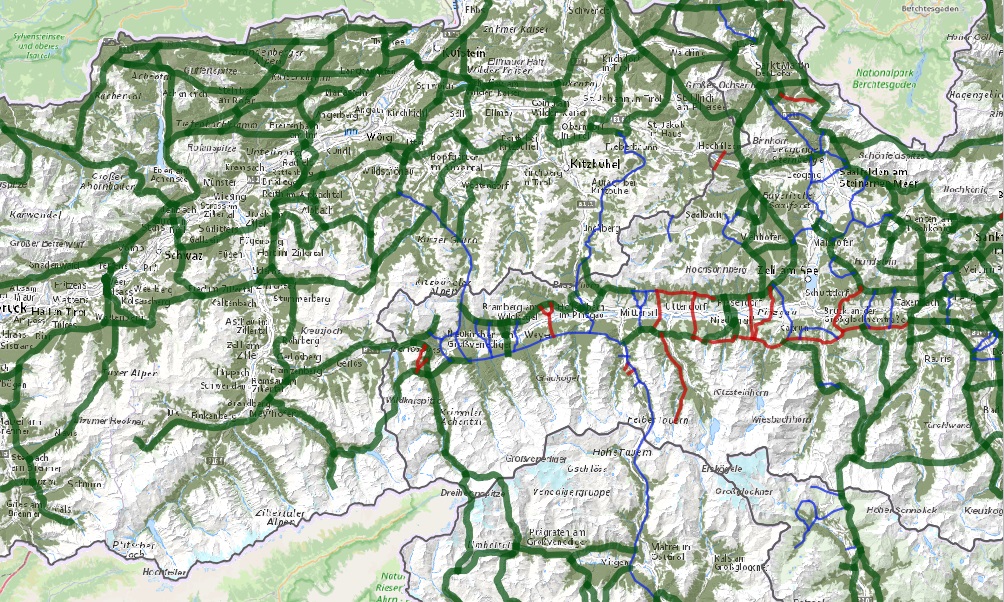
Expert designation of habitat corridors at local, regional and supraregional level. Client for the Pinzgau: Salzburg Provincial Government Department of Spatial Planning and Department of Nature Conservation, Salzburg Hunting Association, Pinzgau Regional Planning. Client for the Lungau, Pongau, Tennengau and Flachgau: Department of Spatial Planning and Department of Nature Conservation, Salzburg Hunting Association. Regional and supra-regional green corridors were included in the regional programs of the Pinzgau and decreed.
-
Project NATREG - Styria: Securing open spaces for people and nature. Detailed information on the project can be found at: https://www.agrar.steiermark.at/cms/beitrag/11944510/100812449/
-
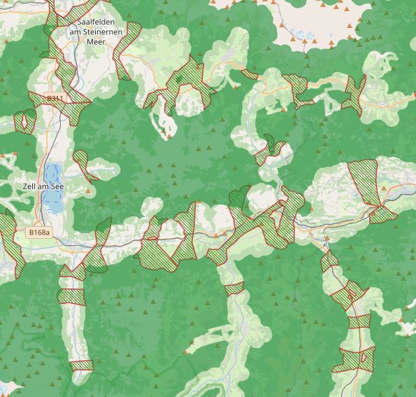
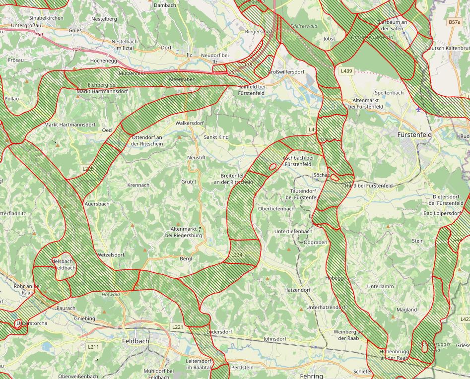
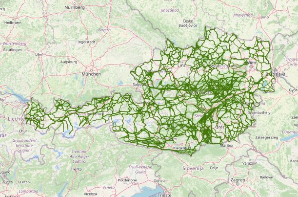
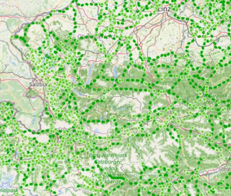
LRVA-2025: Current version of the integral dataset on habitat connectivity in Austria. This dataset takes into account all datasets and designations of habitat corridors from scientific projects and public sector projects (federal provinces). The dataset has been evaluated by the experts of the Cooridnation Platform "Habitat Connectivity Austria" and is updated as soon as new information and designations from projects are available. Further details are available in the endreport: https://docs.umweltbundesamt.at/s/AzZrHid6q9wkDDM As part of the update, the underlying data model was adapted. It is now possible to track all changes made during the update. All updated and valid habitat corridors can be obtained by selecting all edges that have the value “true” in the “valid” data set property. All edges with the value “false” are no longer valid. The reasons for the changes are noted in the ‘comment’ data record property. Most of the changes are so-called “technical changes.” As part of these changes, corridors have been adapted accordingly due to errors in the spatial location of existing crossing structures. The reclassification of corridors is due to new planned or adapted locations of wildlife crossing aids along the existing route. Description of the feature properties see feature catalog: https://geonetwork.lebensraumvernetzung.at/geonetwork/srv/ger/catalog.search#/metadata/e8044763-deb8-43d9-9d51-72b891fe5813 Data set download at: https://docs.umweltbundesamt.at/s/ep9JF44TjYxDY54, also includes QGIS project for direct use of the GPKG file. Two visualizations available. - Corridors classified by corridor category (supra-regional | regional | local) (see Quicklook) - Change layer: Current corridors and all outdated/revised corridor sections
-
Austrian Ecological Corridors - final version. Valued by the experts of the federal provinces. Prepared in the framework of the LE project "Habitat connectivity to safeguard biodiversity in Austria".
-
LRVA-2022: Current version of the integral dataset on habitat connectivity in Austria. This dataset takes into account all datasets and designations of habitat corridors from scientific projects and public sector projects (federal provinces). The dataset has been evaluated by the experts of the Cooridnation Platform "Habitat Connectivity Austria" and is updated as soon as new information and designations from projects are available. Further details are available in the endreport: https://docs.umweltbundesamt.at/s/AzZrHid6q9wkDDM
-
QGIS-Modell für die Aktualisierung der WEP Sonderkarten zur Lebensraumvernetzung. Anhand des Modells können automatisiert nach der Aktualisierung des integralen Datensatzes zur Lebensraumvernetzung in Österreich die Karten im PDF Format neu erstellt werden. Detaillierte Beschreibung siehe Endreport: https://docs.umweltbundesamt.at/s/AzZrHid6q9wkDDM Download QGIS-Modell WEP-Sonderkarten: https://docs.umweltbundesamt.at/s/CjTNNLzPEKbNWyX
-
Ausgewählte Wildtierquerungshilfen über die hochrangige Infrastruktur der ÖBB. Es sind im Viewing Service Wildtierquerungshilfen größer der Kategorie C verfügbar (=Querungsbreite der Bauwerke ist größer als 15 Meter). Bauwerke der Kategorie D und kleiner (>15m Querungsbreite) sind in diesem Viewing Service nicht verfügbar. Die Standorte der Querungsbauwerke stammen aus den GIS Datenbanken der ÖBB INFRA AG und wurden aus einer Kombination aus Vor-Ort Begehungen und der Vermessung via Satellitenbildern kategorisiert. Die Kategorisierung der Bauwerke erfolgte nach FRITZ Völk 2001: WILDQUERUNGSHILFEN ÜBER VERKEHRSTRÄGER – GRUNDLAGEN FÜR DIMENSIONIERUNG UND STANDORTSWAHL IN ÖSTERREICH • Kategorie A (Richtbreite 80 Meter – Mindestbreite 50 Meter) • Kategorie B (Richtbreite 50 Meter – Mindestbreite 30 Meter) • Kategorie C (Richtbreite 25 Meter – Mindestbreite 15 Meter) KEIN DOWNLOAD verfügbar. Anfragen bezüglich der Bereitstellung des Datensatzes als Download bitte direkt an die angeführten Kontakte.
-
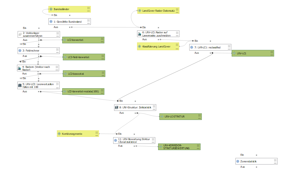
QGIS Modelle für die Berechnung der Bewertung der Lebensraumkorridore in Österreich. in einem Modell ist der Algorithmus für die Segmentierung des Liniengraphen der Lebensraumkorridore in Österreich verfügbar. Im anderen Modell sind die Algorithmen für die Bewertung der Lebensraumkorridorsegmente hinsichtlich der Ausstattung mit Landschaftselementen, der Durchlässigkeit der Landschafsstruktur und der Gesamtindex der Durchlässigkeit der sich aus den beiden erstgenannten zusammensetzt.
-
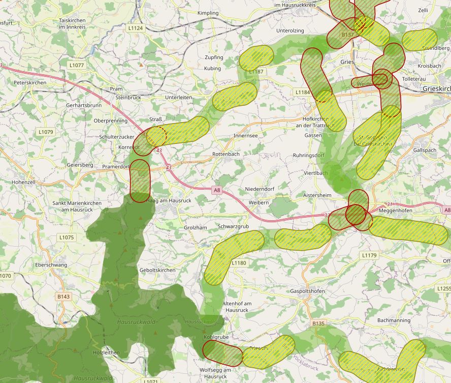
The specific designation of supra-regional migration corridors for larger, preferably forest-bound wildlife is intended to ensure, improve and, if necessary, restore the functionality of a statewide biotope and habitat network. For further information see: http://www.ooe-umweltanwaltschaft.at/xbcr/SID-B49D7CBE-852A8EF6/wildtierkorridore_ooe_2012.pdf
-
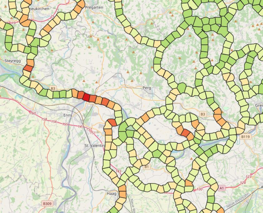
LRVA-2022: Evaluation of ecological corridor axes with regard to the permeability of sections of the ecological corridor. On the one hand, the landscape structure is assessed with regard to its permeability (LC structure index) and on the other hand, the landscape elements equipment of the ecological corridor segment (LE equipment index) is considered. The combination of these two indicators results in the combined ecological corridore index, which gives a good overview of ecological corridor areas with low permeability.