 Lebensraumvernetzung Geodata
biota
Type of resources
Topics
Keywords
Contact for the resource
Provided by
Years
Representation types
Update frequencies
status
Scale
-
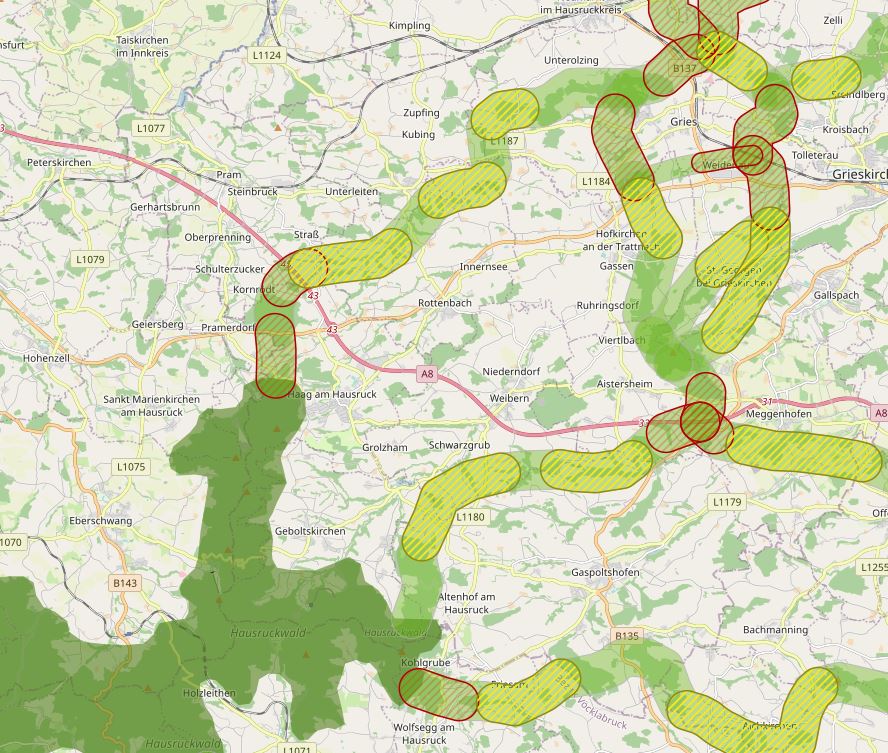
The specific designation of supra-regional migration corridors for larger, preferably forest-bound wildlife is intended to ensure, improve and, if necessary, restore the functionality of a statewide biotope and habitat network. For further information see: http://www.ooe-umweltanwaltschaft.at/xbcr/SID-B49D7CBE-852A8EF6/wildtierkorridore_ooe_2012.pdf
-
First of all, a GIS model was created, which aims to use a least-cost path algorithm to determine the general course of the corridors as precisely and in as much detail as possible. This is particularly necessary because the area under investigation, at more than 30,000km², covers more than a third of the total size of Austria - and thus could not be processed in a justifiable time frame on an expert basis alone. In a next step, the results of the GIS model will be used as a basis for further expert work. This offers the possibility to additionally take into account local particularities as well as findings from workshops, etc. This way, a result can be elaborated that can be used as a basis for the development of the GIS model. In this way, a result can be developed that is spatially accurate even at a scale of 1 : 10,000 - and not only in the bottlenecks. - ConNat-AT as Shapefile:ConNat-AT-KorrEngstKern-UTM-N33.zip Zip -File: complete dataset of all narrows, corridors and core areas in Austria (Esri Shapefile, EPSG 25833 (UTM N33, ETRS 1989)). Attributes: Name (designation), Cat (category: 1 core area, 2 corridor, 3 narrows), Info (link to further information), ESPrior (narrows priority: 0 no narrows, 1 primary narrows, 2 secondary narrows), Area (in ha). - ConNat-AT and Lower Austrian axes as shapefile:NOeWildKorrMittellinieEPSG25833.zip Zip file: Corridor axes in Lower Austria: ConNat and already existing axes from Lower Austria Atlas (Esri Shapefile, EPSG 25833 (UTM N33, ETRS 1989)). Attributes: Name (designation), SymbolID (0 international corridor, 1 supraregional corridor, 2 regional corridor), Buffer (radius in metres), LASTUPDATE (last change).
-
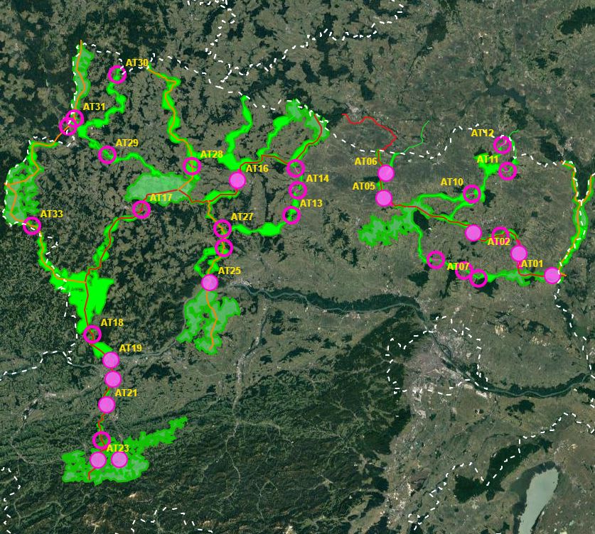
In spring 2019, the NP Thayatal GmbH commissioned the Büro für Wildökologie und Forstwirtschaft e.U. (Office for Wildlife Ecology and Forestry) to prepare a wildcat corridor plan in the Wald- & Weinviertel in Austria and the districts of South Bohemia and South Moravia in the Czech Republic as part of the Interreg project MaGICLandscapes. For the study area in Austria and the Czech Republic, the habitat potential of the European wildcat is to be estimated in the form of a habitat model. Based on the habitat model, a corridor analysis will show the possible distribution routes of the cat. As a further step, a strategy and action plan will be developed to provide a basis for improving and expanding migration corridors and thus dispersal opportunities for the wildcat along the green infrastructure. Within the framework of the MaGICLandscapes project, the research results serve as a basis for the planning, construction and management of green infrastructure. For the National Park Thayatal, they serve as input for the further procedure in wildcat management and are taken into account in the wildcat population support concept. See further information: https://lebensraumvernetzung.at/publikationen/Leitner-2020-Wildkatzenkorridorplan-Endbericht-2021-04-19-web.pdf
-
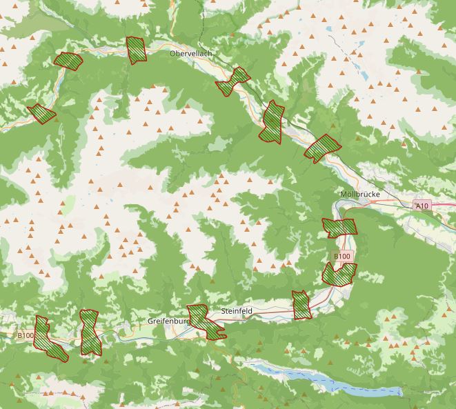
Note on location accuracy: Data sets do not have area-specific delineations and are not suitable to be intersected with the cadastre. Designation of habitat axes in Carinthia. GIS-based modeling with subsequent validation and final designation of migration axes by the "Büro für Wildökologie und Forstwirtschaft"
-
Project NATREG - Styria: Securing open spaces for people and nature. Detailed information on the project can be found at: https://www.agrar.steiermark.at/cms/beitrag/11944510/100812449/
-
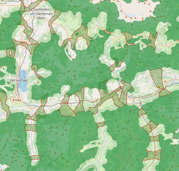
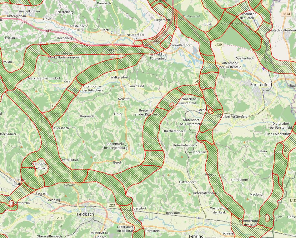
Expert designation of habitat corridors at local, regional and supraregional level. Client for the Pinzgau: Salzburg Provincial Government Department of Spatial Planning and Department of Nature Conservation, Salzburg Hunting Association, Pinzgau Regional Planning. Client for the Lungau, Pongau, Tennengau and Flachgau: Department of Spatial Planning and Department of Nature Conservation, Salzburg Hunting Association. Regional and supra-regional green corridors were included in the regional programs of the Pinzgau and decreed.
-
Modeling the course of the Alpen Kaparten corridor. Consists of the four Bottlenecks and additional core zones of wildlife in-betweeen them. Attributes: -101 - primarily core zone, buffered from centerline 250m to each side -102 - primarily border zone, buffered from core zone 150m -201 - secondary core zone, buffered from centerline 250m to each side -202 - secondary border zone, buffered from core zone 150m -112 - primarily, core - and borderzone are together, buffered 400m from the centerline on each side -0 - core zones of wildlife, big forested areas, only rough delineation
-
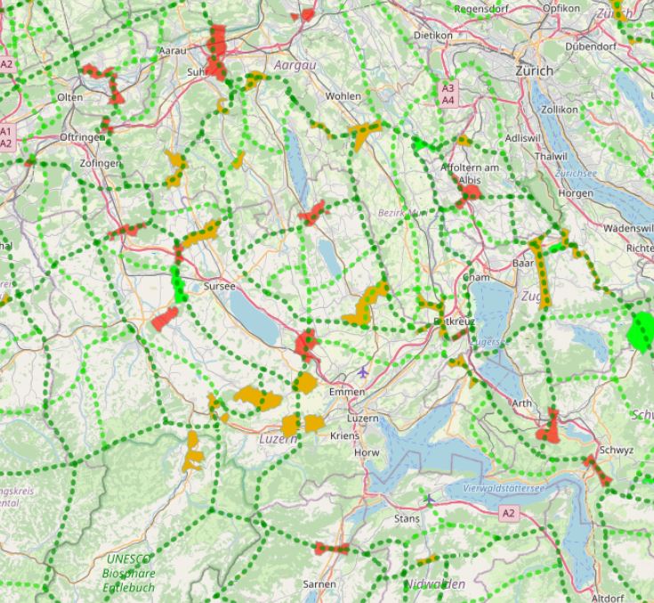
In Switzerland, there are 304 wildlife corridors of supra-regional importance (as of 2020). They connect fragmented ecosystems or suitable habitats and are vital for wildlife. This is because roads and railways form insurmountable barriers for many wild animals. Both large wild animals such as deer and stags, medium-sized ones such as foxes and hares, and small ones such as amphibians or bats need to be able to move for food and reproduction. An assessment of wildlife corridors came to the following conclusion: 47 corridors (16%) are largely disrupted and can no longer be used by wildlife; over half (171 corridors, 56%) are significantly to severely impaired; less than a third (86 corridors, 28 %) can be classified as intact. Geodata information: In a first step, the known wildlife corridors were recorded canton by canton from existing data and potential corridors were identified using GIS and divided into wildlife corridors of supraregional, regional and local interest. Subsequently, the main features of the supraregional and regional network system were visualised for the whole of Switzerland. The corridors were then classified as wildlife corridors of supraregional or regional interest according to the importance of the axis on which they lie. The data for the connecting axes and wildlife corridors were recorded and processed in GIS by the Swiss Ornithological Institute Sempach. The supraregional corridors and the connecting axes were updated by the FOEN in 2012 on the basis of information provided by the cantonal hunting administrations.