 Lebensraumvernetzung Geodata
World
Type of resources
Available actions
Topics
Keywords
Contact for the resource
Provided by
Years
Representation types
Update frequencies
status
Scale
-
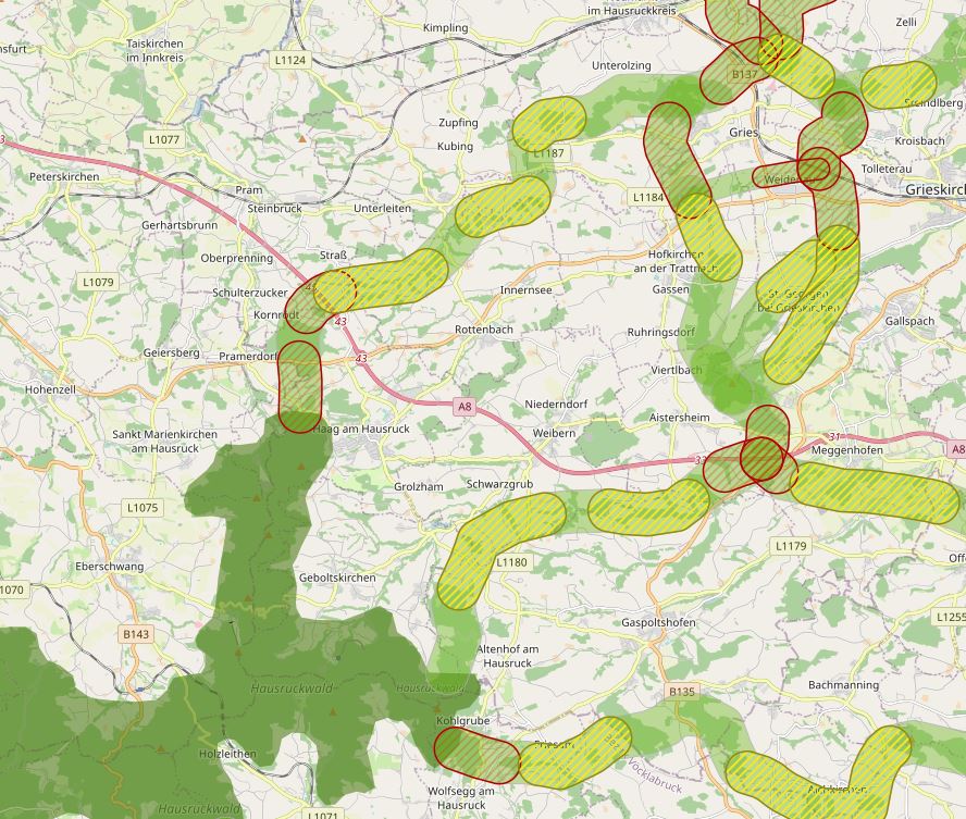
The specific designation of supra-regional migration corridors for larger, preferably forest-bound wildlife is intended to ensure, improve and, if necessary, restore the functionality of a statewide biotope and habitat network. For further information see: http://www.ooe-umweltanwaltschaft.at/xbcr/SID-B49D7CBE-852A8EF6/wildtierkorridore_ooe_2012.pdf
-
First of all, a GIS model was created, which aims to use a least-cost path algorithm to determine the general course of the corridors as precisely and in as much detail as possible. This is particularly necessary because the area under investigation, at more than 30,000km², covers more than a third of the total size of Austria - and thus could not be processed in a justifiable time frame on an expert basis alone. In a next step, the results of the GIS model will be used as a basis for further expert work. This offers the possibility to additionally take into account local particularities as well as findings from workshops, etc. This way, a result can be elaborated that can be used as a basis for the development of the GIS model. In this way, a result can be developed that is spatially accurate even at a scale of 1 : 10,000 - and not only in the bottlenecks. - ConNat-AT as Shapefile:ConNat-AT-KorrEngstKern-UTM-N33.zip Zip -File: complete dataset of all narrows, corridors and core areas in Austria (Esri Shapefile, EPSG 25833 (UTM N33, ETRS 1989)). Attributes: Name (designation), Cat (category: 1 core area, 2 corridor, 3 narrows), Info (link to further information), ESPrior (narrows priority: 0 no narrows, 1 primary narrows, 2 secondary narrows), Area (in ha). - ConNat-AT and Lower Austrian axes as shapefile:NOeWildKorrMittellinieEPSG25833.zip Zip file: Corridor axes in Lower Austria: ConNat and already existing axes from Lower Austria Atlas (Esri Shapefile, EPSG 25833 (UTM N33, ETRS 1989)). Attributes: Name (designation), SymbolID (0 international corridor, 1 supraregional corridor, 2 regional corridor), Buffer (radius in metres), LASTUPDATE (last change).
-
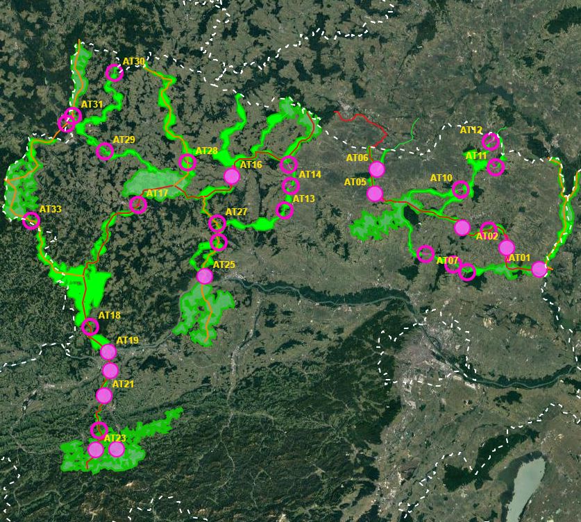
In spring 2019, the NP Thayatal GmbH commissioned the Büro für Wildökologie und Forstwirtschaft e.U. (Office for Wildlife Ecology and Forestry) to prepare a wildcat corridor plan in the Wald- & Weinviertel in Austria and the districts of South Bohemia and South Moravia in the Czech Republic as part of the Interreg project MaGICLandscapes. For the study area in Austria and the Czech Republic, the habitat potential of the European wildcat is to be estimated in the form of a habitat model. Based on the habitat model, a corridor analysis will show the possible distribution routes of the cat. As a further step, a strategy and action plan will be developed to provide a basis for improving and expanding migration corridors and thus dispersal opportunities for the wildcat along the green infrastructure. Within the framework of the MaGICLandscapes project, the research results serve as a basis for the planning, construction and management of green infrastructure. For the National Park Thayatal, they serve as input for the further procedure in wildcat management and are taken into account in the wildcat population support concept. See further information: https://lebensraumvernetzung.at/publikationen/Leitner-2020-Wildkatzenkorridorplan-Endbericht-2021-04-19-web.pdf
-
Modeling the course of the Alpen Kaparten corridor. Consists of the four Bottlenecks and additional core zones of wildlife in-betweeen them. Attributes: -101 - primarily core zone, buffered from centerline 250m to each side -102 - primarily border zone, buffered from core zone 150m -201 - secondary core zone, buffered from centerline 250m to each side -202 - secondary border zone, buffered from core zone 150m -112 - primarily, core - and borderzone are together, buffered 400m from the centerline on each side -0 - core zones of wildlife, big forested areas, only rough delineation
-
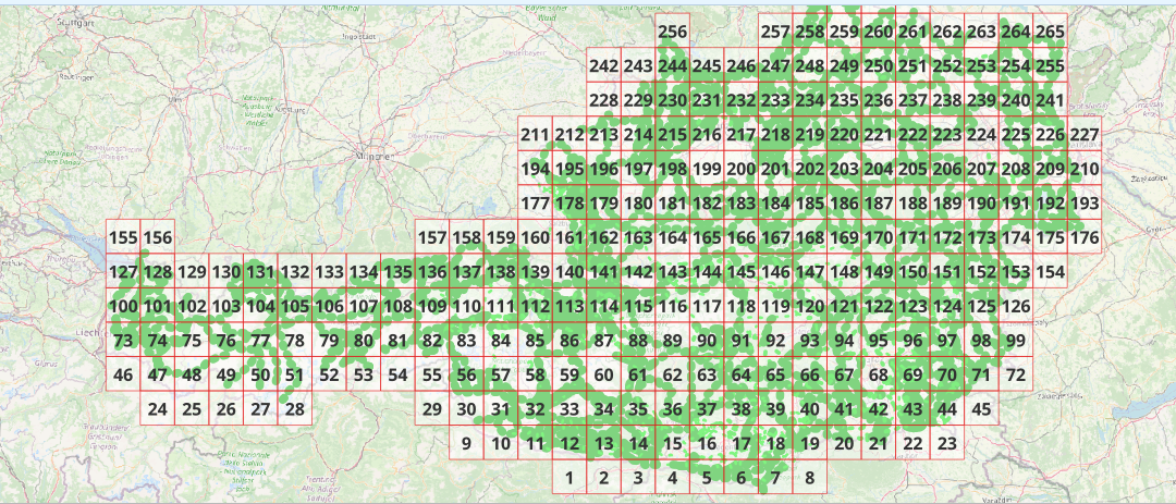
QGIS-Modell für die Aktualisierung der WEP Sonderkarten zur Lebensraumvernetzung. Anhand des Modells können automatisiert nach der Aktualisierung des integralen Datensatzes zur Lebensraumvernetzung in Österreich die Karten im PDF Format neu erstellt werden. Detaillierte Beschreibung siehe Endreport: https://docs.umweltbundesamt.at/s/AzZrHid6q9wkDDM Download QGIS-Modell WEP-Sonderkarten: https://docs.umweltbundesamt.at/s/CjTNNLzPEKbNWyX
-
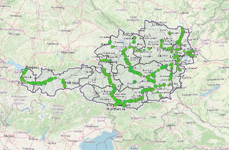
Querungsbauwerke entlang der Autobahnen und Schnellstraßen. Im Datensatz beinhaltet sind alle Querungsbauwerke welche eine Bauwerksbreite größer 30 Meter aufweisen (=Kategorie B: Breite die von Wildtieren bei der Querung der Infrastruktur genützt bzw. zur Verfügung steht) und noch eine wildökologische Funktion aufweisen (=durchlässig oder zumindest teildurchlässig sind). Des Weiteren sind vereinzelte Bauwerke der Kategorie C (15-30 Meter) und D (> 15 Meter) im Datensatz berücksichtigt. Diese werden jedoch nur für jene Bereichen in denen der integrale Datensatz zur Lebensraumvernetzung in Österreich die Autobahnen und Schnellstraßen quert und kein höherwertiges Querungsbauwerk existiert bereitgestellt. Die Querungsbauwerke wurden aus dem Datensatz der im Rahmen der Studie "Kontrollstudie zur Wilddurchlässigkeit auf Autobahnen und Schnellstraßen" aus dem Jahr 2018 erstellt wurde. Dieser wurde in noch einmal visuell kontrolliert. Daten-Download (Geopackage) unter: https://docs.umweltbundesamt.at/s/aKPt5nfeFWJe84q
-
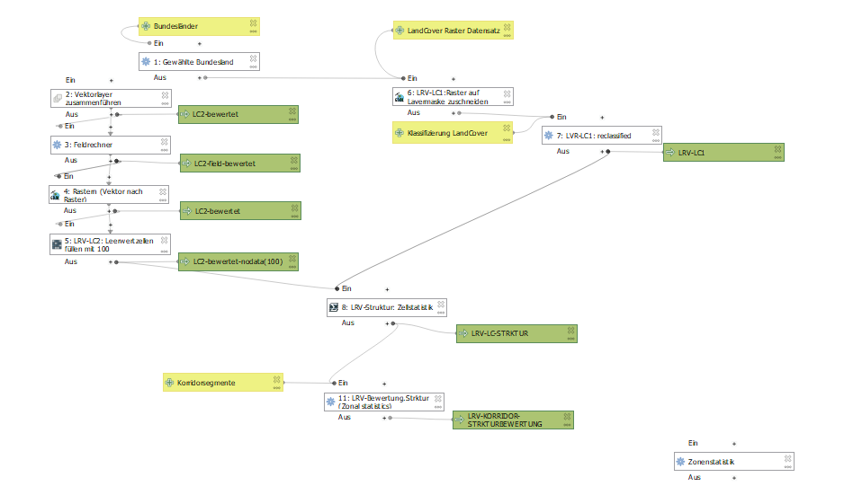
QGIS Modelle für die Berechnung der Bewertung der Lebensraumkorridore in Österreich. in einem Modell ist der Algorithmus für die Segmentierung des Liniengraphen der Lebensraumkorridore in Österreich verfügbar. Im anderen Modell sind die Algorithmen für die Bewertung der Lebensraumkorridorsegmente hinsichtlich der Ausstattung mit Landschaftselementen, der Durchlässigkeit der Landschafsstruktur und der Gesamtindex der Durchlässigkeit der sich aus den beiden erstgenannten zusammensetzt.
-
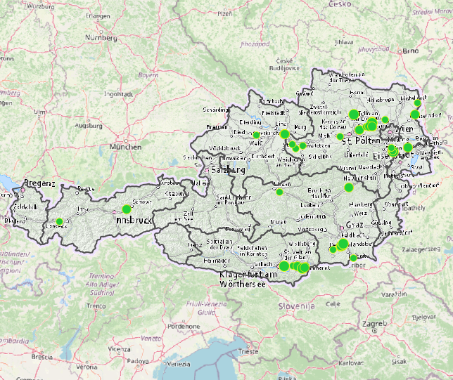
Ausgewählte Wildtierquerungshilfen über die hochrangige Infrastruktur der ÖBB. Es sind im Viewing Service Wildtierquerungshilfen größer der Kategorie C verfügbar (=Querungsbreite der Bauwerke ist größer als 15 Meter). Bauwerke der Kategorie D und kleiner (>15m Querungsbreite) sind in diesem Viewing Service nicht verfügbar. Die Standorte der Querungsbauwerke stammen aus den GIS Datenbanken der ÖBB INFRA AG und wurden aus einer Kombination aus Vor-Ort Begehungen und der Vermessung via Satellitenbildern kategorisiert. Die Kategorisierung der Bauwerke erfolgte nach FRITZ Völk 2001: WILDQUERUNGSHILFEN ÜBER VERKEHRSTRÄGER – GRUNDLAGEN FÜR DIMENSIONIERUNG UND STANDORTSWAHL IN ÖSTERREICH • Kategorie A (Richtbreite 80 Meter – Mindestbreite 50 Meter) • Kategorie B (Richtbreite 50 Meter – Mindestbreite 30 Meter) • Kategorie C (Richtbreite 25 Meter – Mindestbreite 15 Meter) KEIN DOWNLOAD verfügbar. Anfragen bezüglich der Bereitstellung des Datensatzes als Download bitte direkt an die angeführten Kontakte.